
My loaded Surly Puglsey at the beginning of Forest Road 046 in Wallsburg.
I’ve been wanting to take a bikepacking trip for quite awhile now, so with nothing too pressing on my schedule I decided to go for it. I couldn’t get any of the boys to go with me, and it was probably a good thing as it turned into a very difficult ride. I’m not the most meticulous planner; I think deep down I like a sense of adventure, not knowing what is around every bend in the trail. I used mapmyride.com to look at some options, and while I was able to stick to my route, I failed to check the elevations of the route I would be taking. The second half of the trip I decided to take another route I had not planned on and that added significantly to the climbing.
This was a true S24O, or sub-24 hour overnighter. I left Thursday at 2:30 pm and arrived home Friday at 2:15 pm, for a 23 hour and 45 minute outing. It’s amazing what you can do it just one day. I certainly saw a lot of beautiful scenery. And in two days in the mountains I only saw 4 ATV’s and one motorcycle. My Surly Pugsley fatbike performed well. I am still amazed at how well these bikes float over rocks and sand and just about anything else.
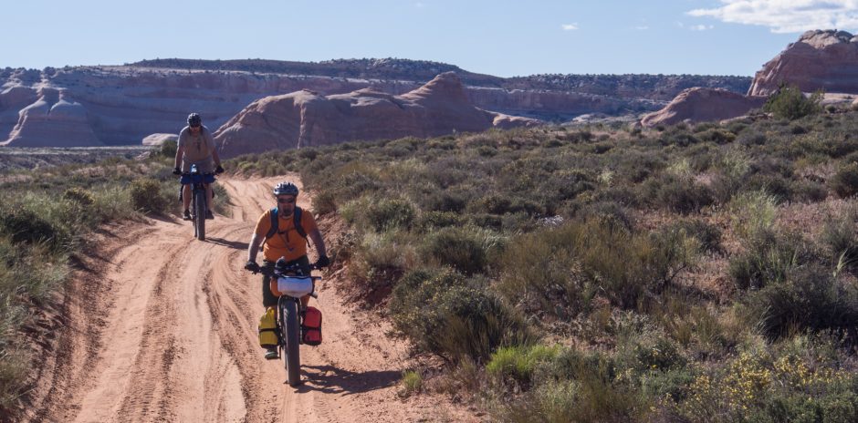
I had my son drop me off in Wallsburg at the beginning of Forest Road 046. It is at the end of E Main Canyon Rd. in the small town of Wallsburg. The road was quite narrow, more like an ATV track. It climbed up through a beautiful valley along a nice creek. I figured there would be some climbing as I was headed up toward Strawberry Ridge, which I knew was quite a bit higher. But I wasn’t prepared for how much climbing I had to do. Along this road I came upon a large herd of sheep. I actually split the herd as one half took off up another dirt road and the other half booked it up the road ahead of me.

FR 046 looking back toward Wallsburg (fairly low in the canyon).

Herd of sheep up ahead.
This road ascended up to a large, beautiful meadow called Big Glade. There was a truck with a trailer there, so I assumed they came up the other way, probably from Daniel’s Summit, as there is no way a large trailer could have made it up the road I came up. I passed one guy on an ATV in this meadow.

Big Glade.
After the meadow, FR 046 climbed gently for another mile or so to the junction with FR 137. I took a right onto 137 and began climbing again.

The beginning of FR 137.

A very rocky road/trail.
This time the road/trail was very steep and rocky. I had to push my bike up several sections. I finally topped out in a pretty grove of aspen trees and views all around. The trail through here was nearly level, with a few gentle ups and downs on a soft dirt track through a large aspen forest. It was a really beautiful area.

Into the aspens.

Smooth riding through a shady aspen grove.

This is the kind of trail I like.

At the top, at least for now.

Looking north toward Highway 40, which is below at the base of the first row of mountains.
A short descent led down into another large meadow. There was another track leading off to the right, so I got my map out and tried to figure out where I was. I also had a GPS app on my phone but discovered that though it tracked my location via satellite, the maps didn’t show up because I didn’t have cell coverage. (I am not very proficient with GPS technology; so far I stick to old fashioned map and compass). Based on my elevation and the contour of the track I had taken I could match that to where I was on the map. Not time to turn off yet. I was headed toward Strawberry Peak. By now I was about 8miles into my ride and had gained over 3400′ of elevation, and I was feeling it.
The trail began climbing again on the other side of the meadow, quite steep in places. I finally climbed up to a rounded grassy knoll and could see Strawberry Peak across the way. There was a large tower with solar panels on the summit.

Strawberry Peak (9714′) in the distance.

Alpine tundra.

Looking back the way I came, from Strawberry Peak.
A short descent through a grassy area brought me to the base of Strawberry Peak, only about 1/4 mile to the top up a steep, rocky ATV track. I went up to the top and took a break. Based on my map it looked like the trail I needed actually went to the summit. But once I got up there, I could see a junction and my trail below. So down I went to the junction of FR 037 and FR 135. I was really relieved that the road were marked as there are countless ATV tracks all over this country and I was afraid of getting lost.

The junction with FR 135, headed toward Hobble Creek Left Fork.

FR 135 going the other direction, with Strawberry Reservoir in the distance.

Most of the roads in this area are part of the Strawberry OHV trail system.
I was so relieved to finally get to the top with a big descent ahead of me. The sun was setting and it was getting chilly so I put my arm warmers on. The first part of FR 135 was great, soft dirt and fast. It wound around through more aspen forests until I hit another junction. This one was not marked, which meant I should stay on this road. But it was hard to tell which one was the right road. I went off a spur just to make sure, and sure enough it dead-ended into a rustic camping area. So I turned around and went down the other road. By this time I was almost out of water and was really thirsty. I came across a spring but it was muddy and slimy, so I decided to press on.

Sun setting through the aspens.
My biggest fear was to take off on some road, heading downhill, only to discover it was the wrong road and I would have to hoof it back up the hill. I was really tired at this point and was not in any mood for more climbing. Twice more I carefully explored side roads. Then as I was descended I saw far down below a glimpse of a dirt road that I thought I recognized from a previous ride. I followed this very rough, and very rocky road down to the another signed intersection, pointing me toward FR 132. Big relief. At this point I was nearly out of water; I had been rationing it for hours and was very thirsty. I knew that there was a creek down along this road, so as soon as I got down to FR 132, sure enough I could hear a tiny babbling. I hopped off my bike, scrambled down off the road and discovered a small creek, only a foot wide this high up. I filtered water and drank until I couldn’t hold anymore, then filled my bottles (I had a one 1 liter Nalgene bottle and a 20 oz. bike bottle). I was at the junction of FR 132 and FR 136. My original plan was to take FR 136 toward either Wardsworth Canyon Trail or into the junction of Hobble Creek Right Fork and Diamond Fork. But I was exhausted and it was getting dark, and I was cold. I knew of nice place to camp a couple miles down FR 132 so I took the path of least resistance and bombed down the road to this small meadow below the road next to the creek. It was a really nice spot. I arrived at about 9:00 pm, and immediately put on warmer clothes. I had ridden 17 miles with about 4500′ of elevation gain and around 3200′ descent.

Finally at camp, and into warmer clothing.
I cooked dinner, then got ready for bed. It was a nice clear night with no bugs, so I just through my tent down (a Mountain Laurel Designs Duomid) on the ground as a ground cloth and slept out under the stars. It was a beautiful night with countless of stars. It got down to the high thirties or low forties. I was in bed by 10 and didn’t get up until 7 am.

Bed for the night.
I was feeling pretty good the next morning and began formulating a new plan. I didn’t want to ride back up the 2-3 miles of road I had descended the night before, so I had a couple other options. One, I could just ride down this road, which was Hobble Creek Left Fork to the road, then ride the road out to Springville and home to Provo. I certainly didn’t like the idea of riding the road for so many miles on my fatbike. So I decided I would ride the road down to the forest service access road about a mile or so up Left Fork from the junction.
I quickly descended Left Fork passing a dozen cars and trucks headed up to the scout camp on my way down.

The road gets wider and smoother the further down you go.

Selfie on the Left Fork road.
4-5 miles on the road and I was at the turn off for the forest service road that turns into the Squaw Peak road.

The access road to the Squaw Peak Road.

A singletrack section heading up toward Camel Pass.

Obstacles. Had to crawl under a huge downed tree then drag my bike through.

Forest Road 027, aka The Squaw Peak Rd.
I had run this road a couple times, both directions, but it had been several years. It turned out to be a real grind. I knew that once you turn the corner and start heading north and can see Utah Valley, there is still more climbing before you finally top out.

Just after turning the corner and feeling really wiped out.
But this section turned out longer than I had remembered and it really whipped me. By the time I topped out, after 3000+’ of climbing I was really beat, and getting very low on water again. It took me 3:15 to top out from the Left Fork road. Part of the time I took the singletrack trail that cut off a few of the switchbacks of the road. This is the trail that the Squaw Peak 50 mile trail run, and the Katchina Mosa 100K trail run use, so I was familiar with it.

South end of Utah Valley.

Heading up toward the saddle, Camel Pass.

Top of Camel Pass looking back toward Springville.

Top of Camel Pass looking north toward Cascade Mountain.
It was really nice to finally get to the top. It was about 12:30 pm and I really looked forward to several miles of downhill. Of course, the downhill was rough and rutted and rocky and it beat me to a pulp.

Lots of downed trees from avalanches.
And my tent kept falling off the back of the bike, one time getting sucked into the back tire (luckily on damage done). It is made of silnylon (including the stuff sack) and my straps had a hard time hanging on. I had my sleeping bag and the tent strapped to my back rack. By the time I got down to the trail the heads down to the Rock Canyon campground I was pretty wasted. It didn’t help that the narrow singletrack trail was very overgrown and there were several downed trees that I had to duck under, then drag my bike under. The Rock Canyon trail is awful.

Dropping into Rock Canyon and the awful rocky trail.

Looking back up Rock Canyon.
Way too steep and way too rocky for my tastes, but I hammered it out pretty quickly, knowing I was almost home. I live only about 1.5 miles from the mouth of Rock Canyon, so I was home in no time.
Total mileage for the trip was 45 miles with around 8000′ of elevation gain. Of those 45 miles only about 6 were on paved roads. I would not recommend this route. Though there were some really nice smooth sections there were too many rough, rocky sections to make it very enjoyable. I’m glad I did the ride and was able to see some new country, but next time I’ll pick another route. The Strawberry area all the way down to Diamond Fork looks like it has tons of potential. I wonder if the other trails are as rocky as the ones I was on.

Great trip and write-up! I found your site by googling “fat bikepacking.” Looks like I will be spending the rest of my morning reading some of your other entries! Thanks for all the details and information. I will certainly put some of your ideas to work here in Alaska.
I would like to use a similar setup on my Pugsley. Would you mind sharing what gear you used? I’d especially like to know which rack you used on the back of the bike.
I’d like to use a similar setup on my Pugsley. Would you mind sharing what gear you used for this trip? I’m especially interested in using the same rear rack- which one is it?
Thanks!
Hi Lance. The rear rack is the Old Man Mountain Sherpa rack. They make one specifically for fat bikes. It’s quite burly and does well. My brother uses a Salsa rack that works well with fat bikes as well. My bikepacking set up has changed a bit over the years and I haven’t used the rear rack the last couple trips. Instead I am using a large rear seat pack. For my most current set up, see this post,