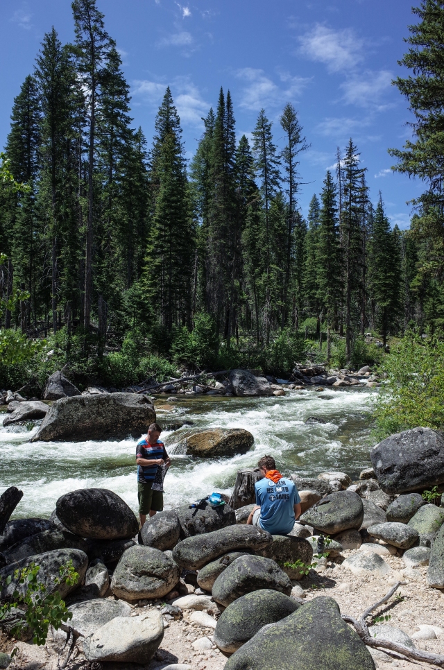
In Bear Valley
I plan a lot of trips. I pour over maps, Google Earth, research campgrounds, towns, obscure roads, and so on. Maybe it’s a kind of therapy, a distraction, something to keep me going when I’d rather be outside. Most trips never happen, but some do. When Adventure Cycling Association came out with the new Idaho Hot Springs Mtb Route (ACA Idaho Hot Springs Route) maps a few years ago I knew I wanted to do it. I had done some touring in Idaho and had checked out some of the hot springs and I definitely wanted to go back and do a dirt route. After an aborted attempt last year, it finally happened this year.

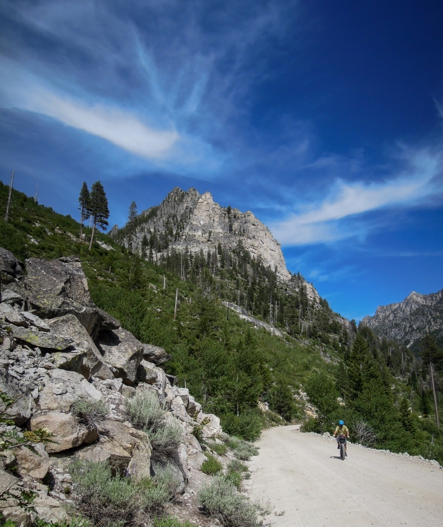
On the way up to Lick Creek Summit
The whole loop is more than 500 miles; since we didn’t have that much time, after some research, we decided to do the northern loop, which is around 250 miles. Conveniently, there is a highway that splits the route into northern and southern sections. Logistics can be a little tricky, but fortunately, I have a good friend in Boise who was willing to drive us to the trailhead and pick us up at the end. Without this kind of help, you’re stuck riding 60 miles of highway, like we did last year. Not fun on a loaded fatbike (or mountain bike).

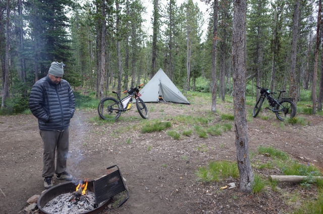
Bench Creek Campground
We drove to Boise last Sunday and met up with my friend Mike and his wife Kris. They drove us in my car up Highway 21 over Banner Summit to a small campground just three miles from the beginning of this section of the route. We had the afternoon to relax and organize our gear. Bench Creek is a nice, typical campgound for the area: picnic tables and pit toilets. No water, but we planned on filtering from natural water sources anyway. It was a chilly night, maybe in the high 30’s. My brother Jason decided on an ultralight 40 degree sleeping bag, which he regretted that first night, as he was cold and not too happy the next morning.
It was indeed chilly on Monday morning, so we bundled up a bit with arm and leg warmers, head bands, gloves, and shell jackets.

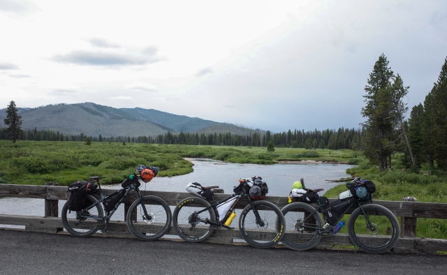
Harrison, Jason’s son riding a Trek hardtail with plus tires

Jason, riding a Salsa Timberjack, also with 3″ tires

Me with my bikepacking workhorse, the Surly Pugsley, with 3.8″ tires
It was a quick 3 miles down the highway to the beginning of the route, which began as a wide, well graded and oiled dirt road.
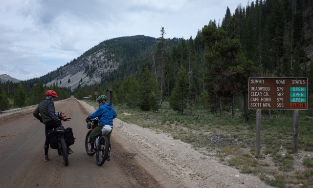
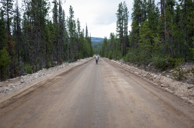

The route began with a modest climb to the top of Cape Horn Summit, only about 3 miles with very short stretches of 8% grades.
When planning this route we figured if we could average 50 miles a day we would finish in 5 days, or 6 days averaging 40 miles a day. We had the whole week open just in case it took us longer. Our longest bikepacking trip in the past was a three and a half day, 156 mile trip in the San Rafael Swell region of Utah (San Rafael Swell trip). We came into this trip with varying degrees of training and fitness. I had been riding quite a lot and was feeling confident.

After about 10 miles we entered an area of open meadows called Bear Valley. The riding was mellow and beautiful.


Once through Bear Valley we turned North and headed toward the old mining town of Deadwood, first climbing a bit, then a nice descent down to the old town site, as well as Deadwood Lodge, a hunting and fishing guide company with a lodge and cabins. We stopped there to refill our bottles, and talk to the owner, who came to the area in 1973 as a cowboy/hunting guide. He gave us the short history of the town of Deadwood, which is now a ghost town, if you could even call it a town now.

The town of Deadwood was first settled in 1867, but didn’t last long. The most activity was silver mining during the two World Wars, where lead was extracted. After that time most mining activity stopped. The Forest Service re-surveyed the land to discover that the whole town was on public land, so most of the buildings were torn down. Deadwood Outfitters relocated three of the cabins onto their property which are now used for guests. The only building, besides some old run down cabins, is a three story building that was the city offices. We poked around a bit on our way through.


The road continued along the Deadwood River as it ascended up toward Deadwood Pass. It was a six mile grind gaining about 1300′ of elevation, the first significant climb of the day.


The day remained cool, thunder often rumbling in the distance, with occasional light showers. It was nice to not have the sun beating down on us.

Looking back at Deadwood Summit
So far, we were impressed with the scenery and the quality of the dirt road. They were usually nicely graded, but we did hit sections of washboard on a regular basis. We were really enjoying the riding, about 40 miles into our day and feeling okay. We checked out a campground, but decided to keep riding. We would stop occasionally to filter water from one of the many rivers and creeks. This was much different than our desert bikepacking trips where we had to carry a ton of water. We each carried two bottles and probably could have got by with one. There was water everywhere, which was really nice. It was enjoyable to take a break along a beautiful stream while filtering water. And to be able to drink as much as you want, with no rationing was also really refreshing. At some point along this section, we decided to try and make it all the way to Warm Lake for the night. However, we did have one more significant climb. Earlier in the day we had run into a guy from Oregon who was riding in the opposite direction. He said the climb up out of Warm Lake was pretty awful and he walked the whole thing. We would be heading in the opposite direction, but still anticipated a stiff climb to the top of the pass.
We were surprised when the dirt road turned to pavement a few miles (14 miles from Deadwood) from Warm Lake. The climb came at the end of the day, and it was very steep. Though it was only 3 miles, it hit grades of 11%. We were tired, and by the time we got to the top, it was blustery and cold again, sprinkling rain. We bundled up, put on our rain shells and bombed down the other side. It was even steeper, longer, and winding, six miles, with more 11% grades, and we were freezing. My bike kept shuttering, then I realized it was because I was shivering. We finally rolled into Warm Lake Lodge at around 5 pm just as it began to rain. Jason wasn’t having any of it. Because he had had a bad night the night before, he announced, “I’m getting a cabin, you can help pay if you want, but I’m getting a cabin.” We didn’t object too much. And we stayed in a really nice cabin run by a nice family from Boise with a bunch of daughters, little ones to teenagers, and a big Great Dane puppy named Ully, short for Ulrich.


Warm Lake, which isn’t warm
Warm Lake has quite a few facilities. The Warm Lake Lodge and Cabins, where we stayed has a small store selling snacks and drinks, and a restaurant and bar. They also have a private campground (quite nice) and there is a Forest Service Campground across the street. Down the road a ways is the North Shore Lodge which also has some facilities. We were so used to being totally self-sufficient on our previous trips, that we weren’t really counting on places to resupply, except the towns of McCall and Cascade. As a result, we packed too much food. We also found the route to not be all that remote. There was a small store at Deadwood as well.
The cabin was really nice and comfortable, and there were hot showers in a building across the grassy area. We felt quite good about our riding for the day and had a very comfortable and pleasant night.
Day One totals: 58 miles, 3653′ elevation gain.

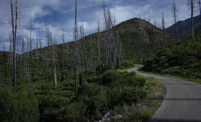
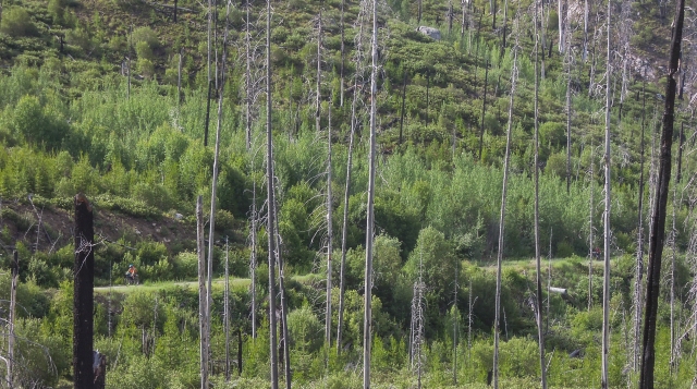
Day two began with a nice stretch of paved road heading North through forested land. The riding was smooth and pleasant. It was nice to not have washboarded dirt roads for a change. The paved road continued for nearly 25 miles, until the turn off to Yellowpine. We were surprised to have so much paved road. When researching the route, I assumed the only paved sections would be through the towns of McCall and Cascade. We weren’t complaining though. The road ran alongside the beautiful South Fork of the Salmon River. We saw a couple Native American fishing camps, (for salmon) along the way. Two tribes have fishing rights there, the Shoshone-Bannock and Nez Pierce Tribes.


There are quite a few airfields throughout the mountains giving hunters and fisherman easy access to the backcountry
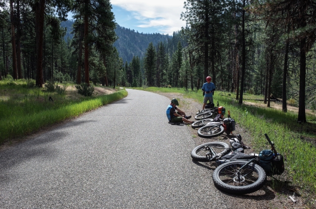
We were approaching the biggest climb of the route, Lick Creek Summit. At the base of the climb we stopped at Ponderosa Campground to filter water, and take break before the climb. It was a beautiful place along the swift Secesh River. We ate lunch, filtered water, and soaked a bit in the cold, bracing river. It was so nice to relax along this beautiful river on a warm summer day, clear blue skies above, the smell of pine in the air, and us on bikes, completely self-sufficient.

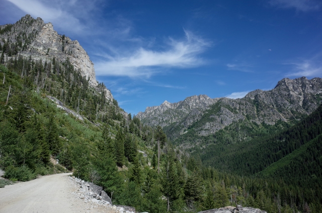
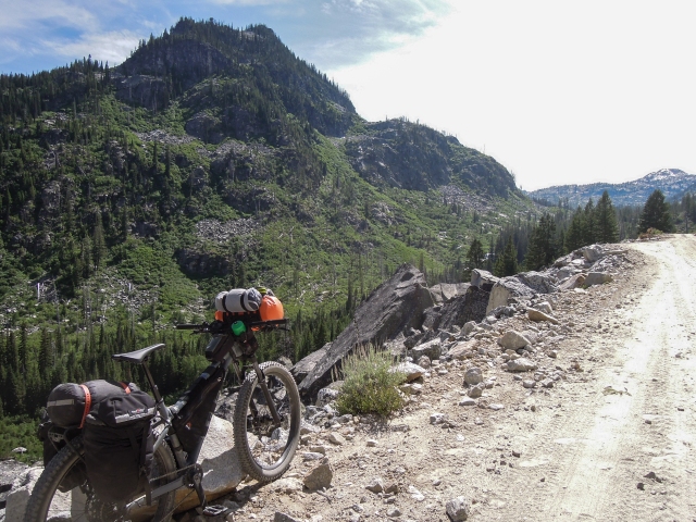
The climb was long, fourteen miles, and the day was hot, and we gained about 2700′. But it was beautiful and I would not want to be anywhere else. We left the forest and the country opened up with high peaks all around.


Though it was a long climb, it never got steeper than 7%. I felt strong, especially the second half of the climb, and was the first to the top. There was a small lake, Summit Lake near the top. We took a short break then cruised down the other side. We were anxious to get to a campsite, and had our sights on a campground about 9 miles down, on the outskirts of McCall. The ride down was fast and enjoyable. We camped at Lake Fork Campground, again, just a picnic table and pit toilets, on the banks of the North Fork of Lake Fork. It’s always nice to go to sleep to the sound of a creek bubbling nearby. Once again, we were pleased with our progress for the day.


Day two totals: 59.7 miles, 5178′ of gain.

Hi! Thank you so much for this blog post! I am planning on doing the Idaho hot springs route with my boyfriend this summer. We’re planning on doing the whole thing with the figure 8 loop crossing that middle section twice. Which I added up 634 miles. We’re planning on 21 riding days 4 zero days (rest days).
My question is when did you do the route? And when would you suggest doing it if we’re riding that many days? I don’t want it to be too cold and not too hot either. Not too hot where we don’t want to soak. I was thinking starting the middle of the last week in June. And if your thoughts would be extremely helpful!!
Hi Carrie. I think we did it in June as well. Of course, weather is also an unknown, but I think June is a good time. That being said, with all the snow we received this year, water may be high, affecting some of the hot springs. See this post from our trip on the south loop,
Good luck. It’s a beautiful area. I think your time frame is good. Riding that highway twice would not be fun though, especially west to east, about 6k of climbing. (I’ve done it before). Going the other way it’s mostly downhill.
Matt